
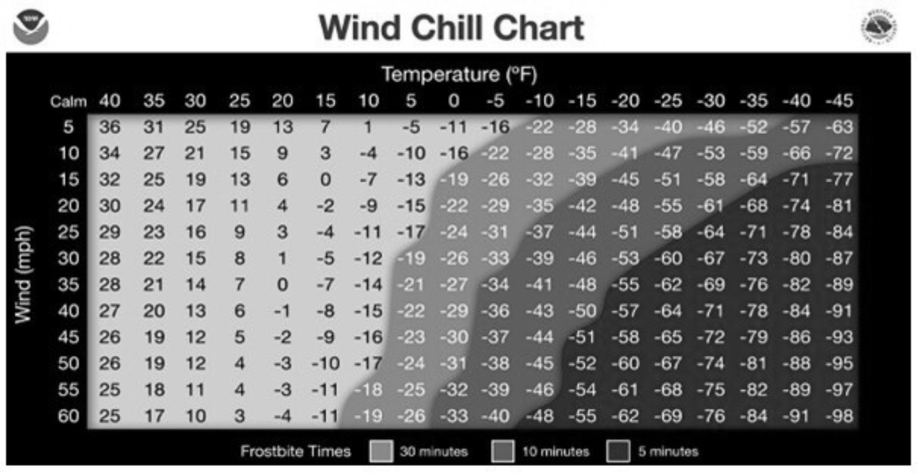
Wind chill is a measure used to account for the rate of heat loss from living organisms. It affects people and animals only; nonliving objects such as buildings, trees and vehicles are not impacted by wind chill.
Wind chill represents an apparent temperature — how cold it feels rather than the actual air temperature. The wind chill formula was updated in 2001 after scientists gained a better understanding of how wind increases heat loss from exposed skin, particularly the face.
For those interested in the science, the formula is:
T(WC) = 35.74 + 0.6215T − 35.75(V⁰·¹⁶) + 0.4275T(V⁰·¹⁶)
In this formula, T(WC) is the wind chill temperature, V is the wind speed in miles per hour, and T is the air temperature in degrees Fahrenheit.
For everyone else, wind chill charts and calculators are widely available online. The National Weather Service provides a wind chill calculator that allows users to determine how cold conditions feel based on temperature and wind speed.
At very low wind speeds, the wind chill temperature is nearly equal to the actual air temperature. This is because the body creates a thin layer of warm air near the skin that provides insulation. As wind speeds increase, that layer of warm air is stripped away more quickly than the body can replace it, making conditions feel much colder. When wind chill values drop to around minus 25 degrees Fahrenheit, exposed skin can freeze in just a few minutes.
To protect yourself during periods of dangerously cold wind chill, dress in several layers of loose-fitting clothing. Layers trap body heat and improve insulation; and wear a hat: the body loses a significant amount of heat through the head, much like heat escaping through a chimney.
Frostbite occurs when body tissue freezes, causing damage. Fingers, toes, earlobes and the nose are most vulnerable. Symptoms include numbness and skin that appears white or pale. If frostbite is suspected, seek medical attention immediately and warm the affected area slowly.
Hypothermia occurs when the body’s core temperature falls below 95 degrees Fahrenheit. Warning signs include uncontrollable shivering, memory loss, confusion, slurred speech, drowsiness and exhaustion. Hypothermia is a medical emergency. The affected person should be moved to a warm, dry environment, dressed in warm clothing, and given warm food or drinks — but no alcohol.

I grew up an Air Force Brat. Traveled the country and lived in Georgia, Maine, New York, Hawaii and Oklahoma.
I fell in love with the weather in Oklahoma. My father was transferred to Tinker AFB in 1973. While in Temporary housing (a mobile home, which is the standard in Oklahoma) I experienced my first severe thunderstorm with strong winds and hail the size of baseballs. The next day I was in the base library looking up books on weather. The rest is history.
I graduated from the University of Oklahoma in 1983 with a Bachelor’s Degree in Meteorology. The first two years we took Calculus, Differential equations, Physics, Chemistry and Computer science classes with the Engineering Students. It was a grind. My degree is actually from the College of Engineering. The last 2-3 year’s focus was on Meteorology including Observational networks (Satellite, Radar, Surface), Physics, Thermodynamics, Dynamics, Synoptic, Winter Weather, Severe Weather and Climatology.
My first job out of college was with a small forecasting company in Oklahoma City. I was immediately put on TV (OETA) and Radio (WKY) as their broadcast Meteorologist. After two years in broadcasting, I decided to pursue the National Weather Service route and got a position in Toledo, OH as an intern. After a couple of years, I was promoted to a forecaster position at the Cleveland Forecast office. I quickly moved into the Weather Preparedness position and was responsible for all the preparedness activities in the state of Ohio.
In 1992 I decided to pursue other forecast opportunities and moved to the Meteorological Operations Division of the National Meteorological Center in Washington, DC. This group is now called WPC (Weather Prediction Center). There I fine-tuned my forecasting of Synoptic Weather with my focus on Heavy Convective Rainfall and Winter Storms, under the supervision of Dr. Louis Uccellini. He has written several books on East Coast Winter storms. I was promoted to a Senior Branch Forecast position during my tenure at MOD. Part of my job was to teach weather classes at COMET (Cooperative Program for Operational Meteorology, Education, and Training).
In 2012 I was given the opportunity to start up a new weather support group with the FAA (Federal Aviation Administration) in Warrenton, VA at the ATCSSC (Air Traffic Control System Command Center). The ATCSCC is where the FAA identifies solutions to air traffic inefficiencies in the NAS (National Air Space) for the CONUS (Continental United State). Weather impacts are the biggest impact on Aviation with yearly losses over 20 billion dollars. My job was to help lower these inefficiencies/costs by providing weather impact briefings and forecasts in order to keep the air planes moving as safely and efficiently as possible.
I retired in 2022 and now am running Lake Anna Weather, LLC.
Subscribe for Updates
Sponsors


Latest Articles
March 2, 2026
Cowgirls (and Boys) Become Weekend Phenomenon at Unionville Brewery

March 2, 2026
County Program Launches Outdoor Adventure Series
March 2, 2026
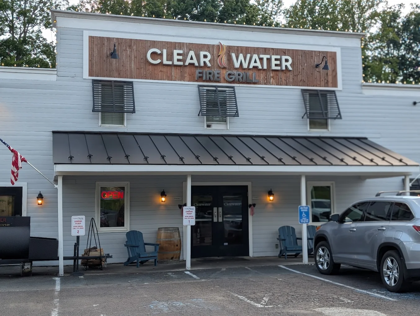
Clearwater Fire Grill Remains a Steady Presence in Locust Grove
March 2, 2026
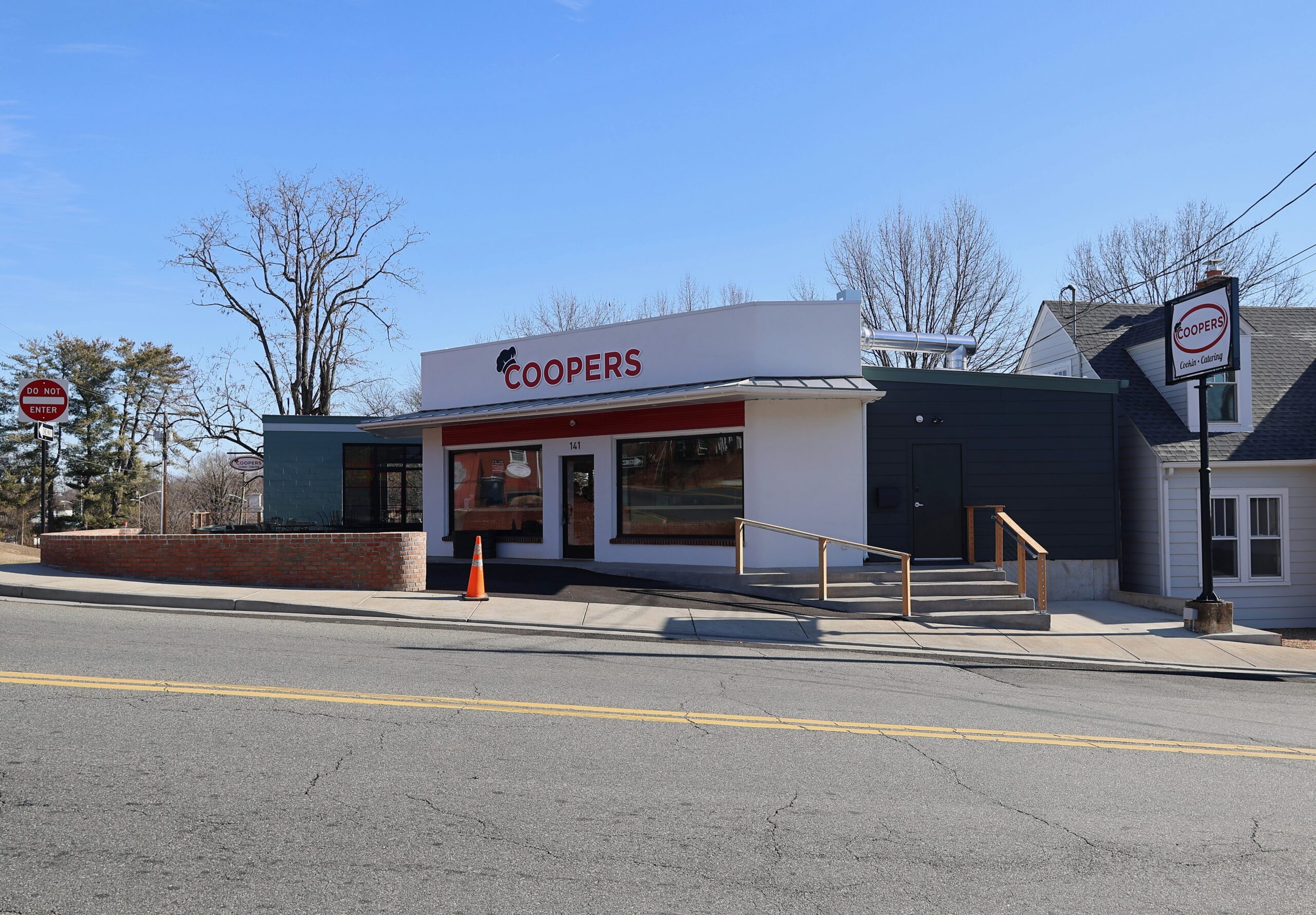
Coopers Cookin’ & Catering Connects Orange to a Reconstruction Era Food Tradition
March 2, 2026
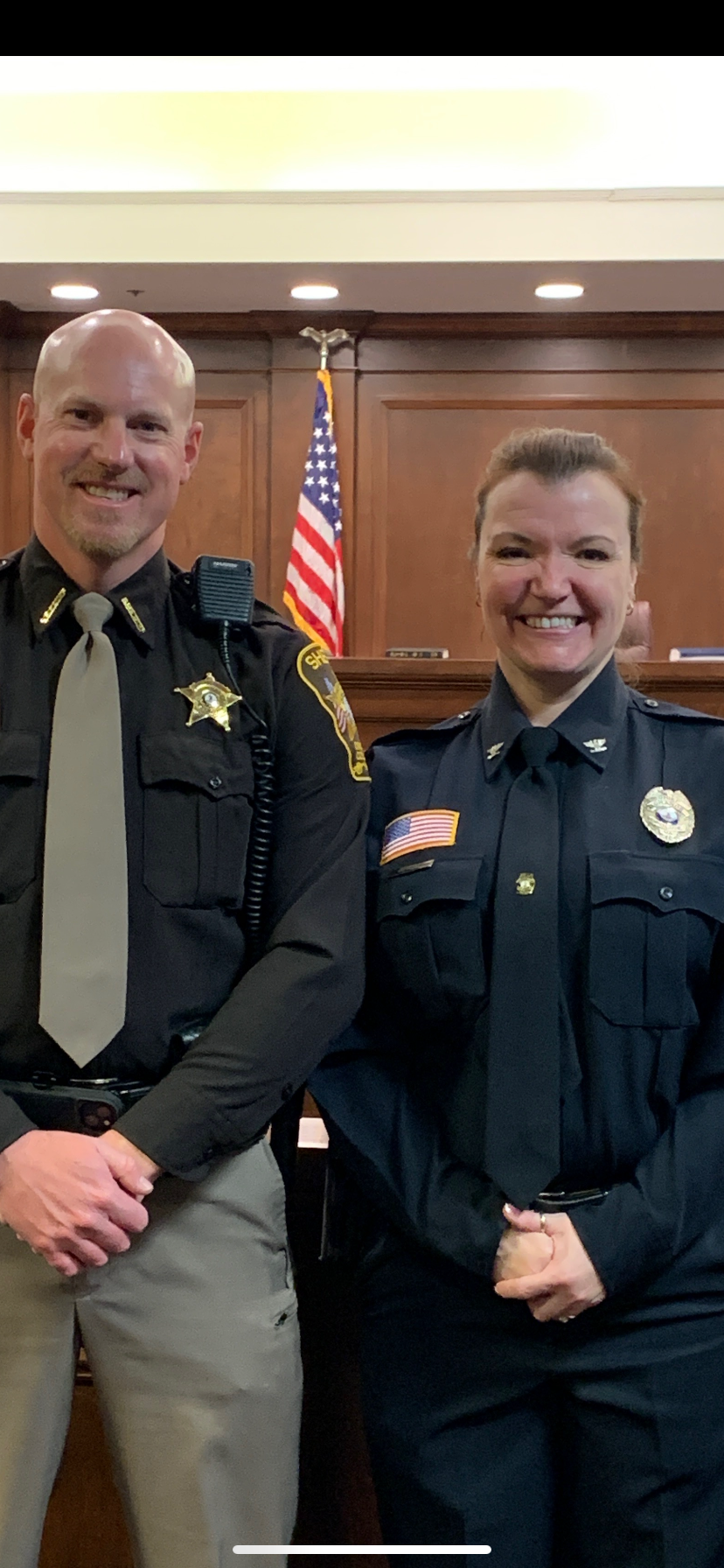
New Police Chief, New Town Manager Mark a Shift in Orange Leadership
March 2, 2026
From 3 to 7%: How Mortgage Rates Reshaped the Housing Market and What it Means for 2026

Wind chill is a measure used to account for the rate of heat loss from living organisms. It affects people and animals only; nonliving objects such as buildings, trees and vehicles are not impacted by wind chill.
Wind chill represents an apparent temperature — how cold it feels rather than the actual air temperature. The wind chill formula was updated in 2001 after scientists gained a better understanding of how wind increases heat loss from exposed skin, particularly the face.
For those interested in the science, the formula is:
T(WC) = 35.74 + 0.6215T − 35.75(V⁰·¹⁶) + 0.4275T(V⁰·¹⁶)
In this formula, T(WC) is the wind chill temperature, V is the wind speed in miles per hour, and T is the air temperature in degrees Fahrenheit.
For everyone else, wind chill charts and calculators are widely available online. The National Weather Service provides a wind chill calculator that allows users to determine how cold conditions feel based on temperature and wind speed.
At very low wind speeds, the wind chill temperature is nearly equal to the actual air temperature. This is because the body creates a thin layer of warm air near the skin that provides insulation. As wind speeds increase, that layer of warm air is stripped away more quickly than the body can replace it, making conditions feel much colder. When wind chill values drop to around minus 25 degrees Fahrenheit, exposed skin can freeze in just a few minutes.
To protect yourself during periods of dangerously cold wind chill, dress in several layers of loose-fitting clothing. Layers trap body heat and improve insulation; and wear a hat: the body loses a significant amount of heat through the head, much like heat escaping through a chimney.
Frostbite occurs when body tissue freezes, causing damage. Fingers, toes, earlobes and the nose are most vulnerable. Symptoms include numbness and skin that appears white or pale. If frostbite is suspected, seek medical attention immediately and warm the affected area slowly.
Hypothermia occurs when the body’s core temperature falls below 95 degrees Fahrenheit. Warning signs include uncontrollable shivering, memory loss, confusion, slurred speech, drowsiness and exhaustion. Hypothermia is a medical emergency. The affected person should be moved to a warm, dry environment, dressed in warm clothing, and given warm food or drinks — but no alcohol.
I grew up an Air Force Brat. Traveled the country and lived in Georgia, Maine, New York, Hawaii and Oklahoma.
I fell in love with the weather in Oklahoma. My father was transferred to Tinker AFB in 1973. While in Temporary housing (a mobile home, which is the standard in Oklahoma) I experienced my first severe thunderstorm with strong winds and hail the size of baseballs. The next day I was in the base library looking up books on weather. The rest is history.
I graduated from the University of Oklahoma in 1983 with a Bachelor’s Degree in Meteorology. The first two years we took Calculus, Differential equations, Physics, Chemistry and Computer science classes with the Engineering Students. It was a grind. My degree is actually from the College of Engineering. The last 2-3 year’s focus was on Meteorology including Observational networks (Satellite, Radar, Surface), Physics, Thermodynamics, Dynamics, Synoptic, Winter Weather, Severe Weather and Climatology.
My first job out of college was with a small forecasting company in Oklahoma City. I was immediately put on TV (OETA) and Radio (WKY) as their broadcast Meteorologist. After two years in broadcasting, I decided to pursue the National Weather Service route and got a position in Toledo, OH as an intern. After a couple of years, I was promoted to a forecaster position at the Cleveland Forecast office. I quickly moved into the Weather Preparedness position and was responsible for all the preparedness activities in the state of Ohio.
In 1992 I decided to pursue other forecast opportunities and moved to the Meteorological Operations Division of the National Meteorological Center in Washington, DC. This group is now called WPC (Weather Prediction Center). There I fine-tuned my forecasting of Synoptic Weather with my focus on Heavy Convective Rainfall and Winter Storms, under the supervision of Dr. Louis Uccellini. He has written several books on East Coast Winter storms. I was promoted to a Senior Branch Forecast position during my tenure at MOD. Part of my job was to teach weather classes at COMET (Cooperative Program for Operational Meteorology, Education, and Training).
In 2012 I was given the opportunity to start up a new weather support group with the FAA (Federal Aviation Administration) in Warrenton, VA at the ATCSSC (Air Traffic Control System Command Center). The ATCSCC is where the FAA identifies solutions to air traffic inefficiencies in the NAS (National Air Space) for the CONUS (Continental United State). Weather impacts are the biggest impact on Aviation with yearly losses over 20 billion dollars. My job was to help lower these inefficiencies/costs by providing weather impact briefings and forecasts in order to keep the air planes moving as safely and efficiently as possible.
I retired in 2022 and now am running Lake Anna Weather, LLC.
Subscribe for Updates
Sponsors
latest articles
March 2, 2026
Cowgirls (and Boys) Become Weekend Phenomenon at Unionville Brewery
March 2, 2026
County Program Launches Outdoor Adventure Series
March 2, 2026
Clearwater Fire Grill Remains a Steady Presence in Locust Grove
March 2, 2026
Coopers Cookin’ & Catering Connects Orange to a Reconstruction Era Food Tradition
March 2, 2026
New Police Chief, New Town Manager Mark a Shift in Orange Leadership
March 2, 2026
From 3 to 7%: How Mortgage Rates Reshaped the Housing Market and What it Means for 2026
Coopers Cookin’ & Catering Connects Orange to a Reconstruction Era Food Tradition
Newly relocated at 141 Caroline Street in Orange, Coopers Cookin’ & Catering serves Southern staples rooted in a family history…
Article By Judi Cooper
New Police Chief, New Town Manager Mark a Shift in Orange Leadership
The Town of Orange opened 2026 with a series of major leadership changes, headlined by the appointment of Rebecca Davis…
Article By Judi Cooper

The OCHS Alumni and Friends Foundation Part Two: Interview with Founder Bill Hager
It is often said that graduation is not the end, but the beginning of a lifelong relationship with one’s alma…